2012/09/25

Midi D' Ossau 2.884m

BASQUE: zer esan mendi mitiko honetaz? Nok eztau aittu iñoz zeozer mendi honetaz? Tipikotik mitikora igaro den mendia da. Itxura eta planta eleganteko mendia, aitz kolore gorrixka hori eta beran paretetan eindeko igoera bide zail eta eskuragarriagoak beste batzuk, Auñamendietako mendi berezienetariko bet izetea iten dau.

Kondairak diño, Gabas(Vallé d'Ossau)-eko artzai batek ardi bet galdu ebela herriti paraje lantzar beten. Harek atzeti segidu eiñ eutson lantzarreti gora. Ardiek gora eta artzaia buru gogor beran atzeti. Ordu betzuk igaro eta gero, Suzon-eko lepora aiega ziran. Antza, lepo hortatik Midi-ra dauen bistaz txoratute, artzaia ardiaz ahaztu ta mendi eder horren gailurrera aiegateko gogoak sartun daken. Esaten deure hori izen zala mendi honetara eiñ zan lelauko igoerea. Mitikoa sekula baino parajeago dauen mendi honetan, edozer gauze posible da.

"euskonews"-etik ataratako argazki

Halan da bere, esan ber da mendi honek dekon bisitari kopurua oso altua dala, masifikaziotik paraje. Kaskoa ezin besteko laguna da mendi hontan, goitik dabiltzesen kordadek bota al datzuten aitzen babesle.
Igoerea bidea oso markatua dago hormara arte. Bertan, paretan hasikeran askori kosta iten dake lelauko tximinia harrapatzea. birriten etor naz mendi hontara eta bi biderrez sartu naz txarto. Argi ibili ber da!

Tximini famatuek ez dake ezelango konplikaziño berezirik. Jakin ber da non gagozen, eta kontu apur betegaz ibilite, ez dau zergatik problemeri egon ber.

Igoereak 3h30'-4h ber dauz Portalet ondoan dauen parkiñeti. handik ordu betera, Pombie-ko aterpea dekogu, beran uzen bariñeko lakuaren parean dauena, mendi paretaren oinarrian.

Midi d'Ossau udabarrian col du Pombietik / Midi on spring from col du Pombie

ENGLISH: This mytical mountain, is one the most espectacular one in the pyrenees. It doesn't reach 3.000 meteres but It's so estetic and incredible. A lot of clinber try climbing it on summer. The summit way is not very technical but requires some knowledge on ropes. At the base of the mountain, there's a refuge close to a lake. 

Maybe we're going to describe one of the most popular ascension on pyrenees, but not the easyest one!, we must always carry our helmet with us and at least 30m rope. The ascen from the normal way requires 3h30' from the parking and 2h30' from the refuge.

Midi kokatzen / Where's Midi?


DENBORAK/ Timetable

Parking Cabane d' Arraile - refuge Pombieko aterpea: 1h5' (F)
Refuge du Pombieko aterpea - horma oinarrira/rock base: 50' (F)
Horam oinarritik /Base of the way - Gailurra/Top: 1h45' (F+)


DESKRIZPIOA  Description

Portalet-eko muga portutik igaro ostean, kilometro 1 ingergu pasata Frantziko norantzan, eskoietara dekogu parking bet kotxea itziteko. Bertatik urteten da bide gora igoteko. Ordu baten buruan, Pombieko lepora aiegaten gara, bista eleganteak eukinda Midi-taz argazkian ikusten danlez. 

From the Portalet mountaing pass, we cross the border on France way and immediately we park the car. From here, we take the trail. O our later, we reach Pombie's hill. (photo)

Ponbieko lakutik Midi d'Ossau. From Pombie lake Midi d'Ossau.

Refuge Pombieko aterpea (1h5', F)

Suzon-eko leporantza. Aterpetik Suzon-eko lepora 30 minutu inguruko bidea dekogu. On way to Suzon hill. From the refuge we've got 30mins way.

Suzon-eko lepotik, Midi-n gora ein beharreko bidea ikusgai. 500m haitzean, 3 tximini tartean ditugula. Pausurik larriena IIº-koa izango da. From Suzon hill, we can appreciate the way to the summit. 500 metres rock, with 3 vertical steps, wich the most difficult level is around II
Pareta oinarrian (50min aterpetik/ from the refuge, F+) 
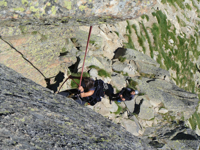
1º tximiniko argazkirik ez gendun atara igoera bidean, ez baikenuen harrapatu bide zuzena. Akaberan, bajakeran dau argazki bet 1º tximiniarena.Hurrengo argazkian, 2º tximinia dekogu ikusgai. We've not photos from the 1º difficult step, because we loose the way on the ascension. on this next photo we can see the 2nd step. 

2. tximinia superaten (40min pareta oinarritik, F+Overcoming 2nd step.

Ingurura begiratuta, sekulako bistak dekoguz: Palas, Balaitous, Arriel, Lurien, Frondellas seen from Midi.

2. tximinia igarota, altuerera irebaziz goazela konturatzen gara. 2nd step overcomed, we're gaining some height.

3. tximiniara aiegaten. Reaching 3rd step.(1h10' Horma oinarritik/rock base, F+)

3. tximinia, 3etatik luzeena. the 3rd step, the longest one.
 3. tximiniatik urteten. going out from the 3rd step.

Gitxi falta daku gailurreraino... astun iten daku parte hau. Close from  the top, we're tired!

Gailurra: 2.884m (1h45' horma oinarritik / from base of the rock, F+)
 3. tximinia rapelatzen, seguramente ez da ber rapelatzea, baie holan kordekaz praktikaten dogu. Doing a rappel on 3rd step. It's not so necessary to mount the rappel, but it's going to help us gfrom the travel to Alps. 
 1. tximinia rapelatzen. rappel honen ostean, bedarran sartungo gara ostabere, haitza atzean itzite. On the 1st rappel. After going down on this part, we're going to start walking on grass again.
 Azkenik, aterperaino, eta handik kotxeraino. bidean, marmota xelebre hau ikusi gendun. Then, from rock to the refuge and then to the car. 


2012/09/23

Lautadatik Auñamendietara / From the plain to the Pyrenees

BASQUE: "Lur Anitza" diño Nafarroako turismo bulegoko leloak. Holan da, duda barik. Ez nendun pentsetan 10km-tako tarte batean, horren paisaia aldaketa bortitza gerta leitikeenik. Urrotz herria, lautada eta zereal lurretan lasai dabil. Handik 10km-tara, Zuntzarren herrian pagoak agertuz doaz, alboko lantzarretan bedarra dekogu, eta haragi behiak agertuz doaz, euskal behi pirenaikoak. 

Ibilbidea, Urrotz utzita atzean, Litzoaingo bailara ederrean sartzen da. Apenas kotxe bako bide hontan, Erro errekaren norabidea gorantza segituz goaz aldapa gogor barik, gorantz beti baina ia izerdi tantak bota barik. Errotik 3 km-tara aiegaten gagozela, aldapak apur bet tentetzen dire baie paisaia bere edertuz doa. Arteak gero eta gitxiago eta Pagoak sarri ikus leitikez. 

ENGLISH: "Land of diversity" says Navarre's motto. That's great and in this route we've verified. At a distance of 10km, the landscape changes completely. In Urrotz, the landscape is so brown, made by cereal fields. Then, 10km after, we find green, grass and trees like beeches and oaks. 

The way goes through Litzoain valley. There's no too much traffic, it's very quiet and nature exploits so sweety. 

Egindako bidea / the way

Bide profila eta datu orokorrak. Profile and some route data

Urteera / Departure

Paisaia Urrotzetik paraje / Landscape close to Urrotz

Kilomteroak aurrera eiten goazela paisaia aldatuz doa. Makalak, arteak / some km after departure,  appear poplar and ilex trees. 
 Aitzarte ederra Errorako bidean / Incredible gorge in Litzoain valley

Erroibarrera sartunde, Euskal behi pirenaikoak ikusteko aukerea dekogu. Honek, klima alpinoago baten ondorio baino ez da. Basque pyrenne cow close to Erro village. 

Erro-ko herria. Elexa jaun eta jabe. Erro village, Basque typical houses. (760m) 

Erroko "Arraiz-etxea". 

Erro

Erroko herria atzean itzita, bagoaz bailaran gora. Seinaleak diñoen lez, errepidea bastante irregularra da. We let Erro and we go straight to the next village.  


Bizkarretako herri sarreran, etze izugarri honegaz egingo dogu topo. Errotik Aurizperrirako bide oson, erromes asko ikusten doguz Santiagorako bidean. Berez, Hemendik gertu hasten da ibilbiderik ezagunena: Orregatik. 

At the edge of the town we find this incredible basque house. From Erro town to Aurizperri, we are in road with a lot of pilgrims on way to Santiago. Close this place is Orreaga, the famous town where departures the most famous of the Santiago's way. 

Bizkarretako frontoia. Nahiz eta Erroko bailarako teilatu tipikoa ez den, hemen ikus leitike 4 uretako teilatu bat, Auritz eta aurizperriko herrietan amankomunagoa den teilatu mota. Aezkoako bailarana ere asko ikus leitikez era honetakoak. Ederrak

Fronton of Bizkarreta. We can see the second houses hipped roof. It's typical of more alpinistic towns like Auritz, Orreaga, and all of the towns of Aezkoa valley. 
 Mezkiritz herria ikus leitike herri nagusitik. Hemendik, hasten da portua. 2,7-3km-ko portua. Ez da oso bertikala baina izerdia botaten da, bai jauna!!! Mezkiritz town from the principal road. Here starts mezkiritz's mountain pass. It's around 3km long and thers's no so hard... 

Akaberan aiegatu gara gora... At last we reach the top! 

Mezkiritz goitik, Iparraldeko mendiak ikusgai Garazi ingeruan. From Mezkiritz, moutains of North Basque Country, in Cize department. 
 Izugarri ederra den Aurizperri herria. Etxe mehe eta garaiak, bata bestearengndik gertu neguetan hotza kentzeko asmoagaz. Nahiz eta udagoieneko lehen egunean gagozen, hasi gara tximinietako egurra usaintzen. Etze guztiak haien eskual izena deke. Aurizperri, Eskuara entzuteko aukerea dago oraindik ere. Goi nafarrera du herri honek hizkeratzat. 

This is the principal road of Aurizperri (Espinal is Spanish) town. Tall and narrowe houses, so close together between them. Although summer ended yesterday, we can smell wood smokestacks. All houses have their basque ancest name. In this time, we can ear Basque, with northern-Navarre dialect.  

Lau aldeko teilatua. Hipper roofs 

 Edurrentzako teilatu pikoak. Steep roofs because the snow. 


Aurizperriko elexa. zuzen zerura... Aurizperri's church, straight to heaven...

Behin Aurizperri igarota, 1km eta erdira, debideraketa dekogu hegoalderantza, pirinioetatik urrunduz, Agoitzerako bidean. Bidearen lehen 10km-ak Artzeko bailaran egiten dire. Oso ingurune aberatsa da. Kotxe barik, Urrobi erreka segituz hegoalderantza goaz. 

After leaving Aurizperri, we turn right to Agoitz. We leave the pyrenees taking the road to the south. First 10 km are very rich and green. We go to the south following the Urrobi river. 


2012/09/19

Castor 4.224m eta bere ertza / Castor Peak 4.224m and it's edge

BASQUE: Castor mendia, Monte Rosa mendi multzo barruan dauen tontorra dekogu, Italia eta Suitzako herrien arteko mugean. Alpe Peninoetako inguru hau, oso bisitatua da, halan da bere, ezin leitike konparatu paraje dagozan  Mont Blanc edota Zermat-ekaz, bertan dauena turismoa baino masifikazioa da.

Gu mendi honetara igoerea egiteko, Aosta barruan dauen Gressoney haranertik egin dogu gora Stafal izeneko gunera arte mendien magalean. Aosta, Italia barruan dauen bailara berezia da, autonomia berezia duen probintzi edo kantonamendu bakarra izanda. Aostako bailara guztian, hizkuntz ofizialak Italiera eta Frantzesa direz. Aostako bailara, Saboyako erregeak eukiezan gazteluez josite dau. Bi berba hauetaz aparte, saboiera bere aittu lei ingeru batzuten.

ENGLISH: Castor Peak, belongs to the Monte Rosa  range, between Italy and Switzerland. We reach the summit by the south way, from Aosta valley (Italy). Aosta valley is a particular community into Italy. It's the only valley with two oficial languages in Italy: Italian and Frech. Another language appears on rural villages too: Savoyan. It's come from the French part, so close to Aosta. 

On the east of Aosta, we've got Gressoney valley. From this valley we carried out the ascension to Castor peak. In the valley of Gressoney, they've got another language than the other two: "Walser". Walser, is a dialect from Deutsch (German) witch it's spoken on some rural places on the north of the valley. Unfortunately, has happens to us in the Basque Country, minority languages are despised by autority. 


 Saboyako Gaztelua Gressoney St.-Jean herritik paraje / Savoy castle in Gressoney St.-Jean 

Aostak osotzen dauzen bailen artean, ekialdera dauena Gressoneykoa dekogu. Bertan, Frantzesa eta Italieraz aparte, Alemaniera daki bailarako iparrean bizi direzenak. Bailara hontako biztanleek "Walser" uzenagaz ezetuten dire, erro germanoa dekon hitza.

Walserren dialektoan atsiñe idatzitako testua / Plaque written in Walser (Gressoney St.-Jean) 

Egun, eskolan Frantsa, Alemana eta zelan, Italiera ikisten deure umeek. Halan da bere esan ber da geurean lez, hizkuntz gutxituek (kasu hontan "Walserren" dialektua) bastante diskriminatute dagozala Italieraren mesedetara.
Gressoney La Trinitè herriko eskolan, Walser-era nagusi / Drawing in Gressoney La Trinité's school

: Antza danez, erdi aroko izotzen urtutzeen ostean, Monte Rosa mendiaren ipar aurpegia bizi ebezan suitzarrek (berbaz alemana eukiezenak) muga pastu ta Gressoney finkatu ei ziran.

The hypothesis to explain how Walser is spoken in Italy is that in the middle ages, when the ices from Monte Rosa come thawn, people from north face of Monte Rosa came to the south. To this day, a few centuries later, Walser is still spoken. 
Castor Gressoney St.-Jeandik /Castor Peak from Gressoney St.-Jean


ZAILTASUNA / difficulty: Piriniotako negu igoera baten moduko sailka leitike. Edurretan ibili ber da, tenperatek 0ºC-ren dabiltze ta kranponekaz ibilten jakin ber da. Ez deko ezelango zailtasun aipagarririk. 

The ascension's difficulty is comparable with a winter ascension in Pyrennees. We must know how to use cranpons, piolet. The temperature on summit is going to be on summer always close to 0ºC. 

DENBOREAK / Timetable:  Stafal - Quintino Sella : 3h30' (F)
                                                Quintino Sella - Castor : 2h20' (F+)


1. Eguna: Col Bettaforca - refuge Quintino Sella Aterpetxea (3h30', F)

-DESNIBELA / Gradient: 900m 
-DISTANTZIA/Distance: 4.12km
-ZAILTASUNA/ Difficulty: F
-DESKRIBAPENA/ Description
   IIº-ko pausuak daude, baina korda finkoekin ekipatuak dagoz. Bestela, ez dau ezelango galtzeko     arriskurik. 2nd level steps, without risk because there's rope fixed along the way. 


Gure estiloari leial, Castor mendi apal baina polit honetara igotzea saikaera egin gendun. Aklimatazio prosezurik ez gendun eukin, asike geldiro geldiro igotzen hasi gintzen aterpera. Stafaletik urteten dan kableak, 2.700 metrotara itziten datzu col de Bettaforcan, gero ostera, beste 900 metroko desnibela in ber da Quintino Sellako aterperaino aiegateko

Nahiz eta aterpeak ogeak dekozen, geuk kanpin dendea eroatea erabaki gendun, horrek suposatzen dauen gauzekaz: lo sakue, esterilla, kanping gasa, afaria... barriz bere motxila txarto inte eta pisu lar eroan gendun... Pasa gintzen pisuakaz!!! 

ENGLISH: we carry the tent up from the village, although we knew ther was a shelter. The rucksack was soo heavy, we make a big mystake carrying a lot of unuseful things.


(0:10', F) Bettaforcatik urten eta oso bide ebidentetik iten dogu aurrera. Hanik hamar mnutura, bista ederrak dekoguz. / after leaving Bettaforca, we go gainig heigh. After 10minutes, we can see this espectacular view. 

 Aterperako bidean, atzean Lyskamm izugarriak / Going to refuge, behind Lyskamm

(2h15', F): Pausu ebidenteetik aurrera iten dogu. Haitza gero eta astunagoa iten daku, altuereak bere, protagonismoa hartu dau eta gorputzek ez daku behar ebste ondo erantzuten. There's no problem to find the way to the refuge. There's a lo of people but the altitude makes us feel bad, tired. 

 Jendetza aterperako bidean / overcrowed way...

(3h, F) Aterperako bidean dekogun akaberako partean, korda finkoeri eutsiz IIº-ko pausuek igarote doguz. Urrengo argazkian, aterpetik paraje, akabuko metroak. / This is the last part of the ascension to the refuge. We're so tired, but we can see the tents near to us. 
Markak eta atzeko partean Castor / Marks and behind them Castor peak

Korda finkoak / Fixed rope
 Korda finkoak aterperako bide turistikoan / fixer rope on tourist route


(3H15', F): Quintino Sellako atrepe ingurua. Lehertuta aiegatu gara 2 faktoreengatik: Pisu asko daroagu gure bizkarrean eta ez dogu aklimataziñorik eiñ. We arrive to Quintino Sella refuge. Behind, we've got tomorrow's objective; Castor 4.223m

 Gure dendea aterpe kanpoan parata / Our tent on base camp


2. Eguna: Quintino Sella - Felikjoch 4.093m - Felikhorn 4.174m - Castor SE 4.194m - Castor 4.224m : 5h25', F+

-DESNIBELA / Gradient: 800m
-DISTANTZIA/ Distance: 7.45km
-ZAILTASUNA/ Difficulty: F+

Gabeti buruko mina eukinda, aklimatatze ezak faktura paseko ote eustan? BA BAI!! Halan da bere nahiz eta gitxi lo ein, 4:30tan esnatu, prestatu, gosaldu eta enkordatu gintzen. Glaziarreko parte itsusiena hasikerakoa da, grietak dagozan lekun. Halan da bere jakinte gero ertz apur bet zorrotza etorrela, enkordaute segitu gendun tontorretik itzuli arte. Igoera erreza, baina altuereak afektaturik, ezin gozatu, buruen aldiro burrun-burrunka.

Igoerako parte ikusgarriena Castorren ertza da duda barik. Oso ertz estetiko eta polita da, zailtasun baxukoa eta aldi berean entretenigarria. Ertzean, Castorretaz aparte, beste hiru mendi igo genduezan.

During the night I had headache because the altitude. Even so, next mornig at 4:30 we wooke up, have breakfast, and tyight each other. The most dangerous part is the first one, close to the tent, were the glacier is so broken. 

The best part of the ascension it's the Castor edge, were we reach a part from Castor another three peaks.


 Lehen argiak goizeko 6:30ak aldera / first shines at 6:30am aprox. 
 iladak ertzaren bila / people row getting closer to the edge
 Lyskamm
 Mirian eta atzean lehen mendia; Felik sorbalda: 4.096m / Mirian and behind her first peak: Felikjoch 4.096m

 Castorren ertza punta Felik.etik 4.167m / Castor's edge from Felik Peak 4.167m
 Ertza / Edge
 azken pausuak gogorrak iten datez... / final steps became so dificult for me
 Castorren gailurra, atzean Monte Rosa Ingeru / Castor's summit, behaind Monte Rosa range

 Ederra da ertza... / incredible edge

 Beste gailurra, Felik-en sorbalda / Felikjoch

Leher einde, baie pozik / so tired, but happy